Listen to the sound of the rushing wind and enter the world of pirate invasions from the south-east, the fearsome Barbary corsairs. Explore the most important places of defence and control of the coasts and territory, relive the most compelling and hidden episodes of our past through official historical sources.
STAGE 1
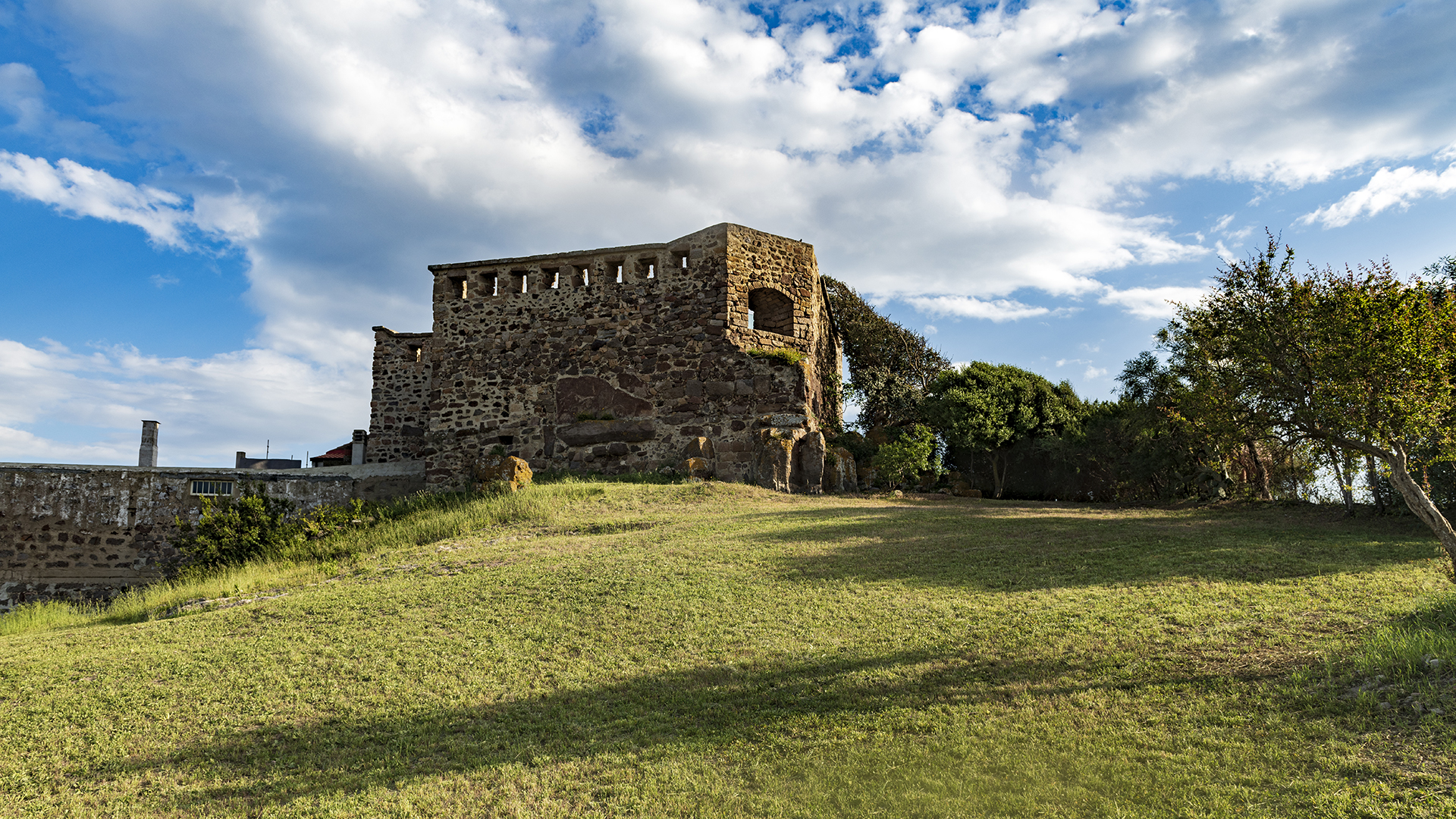
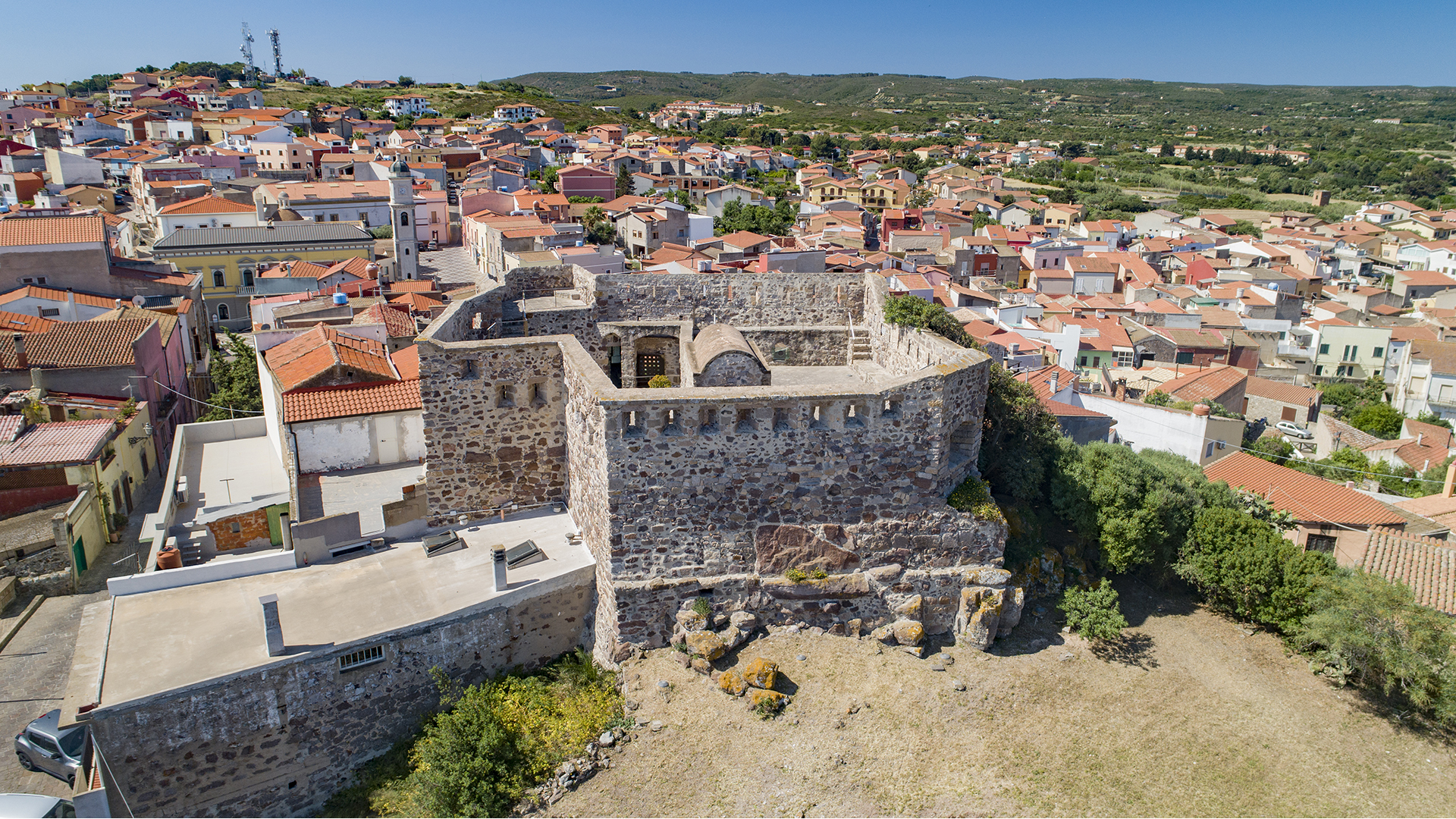
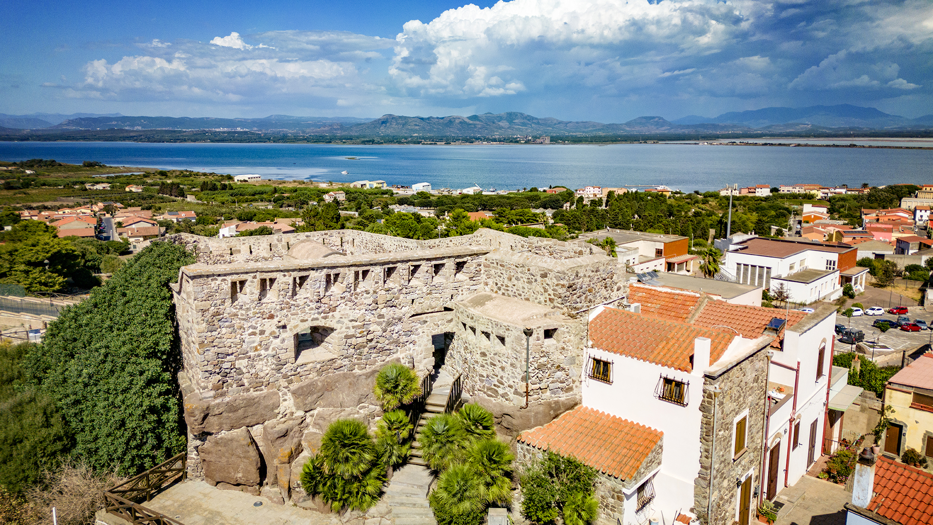
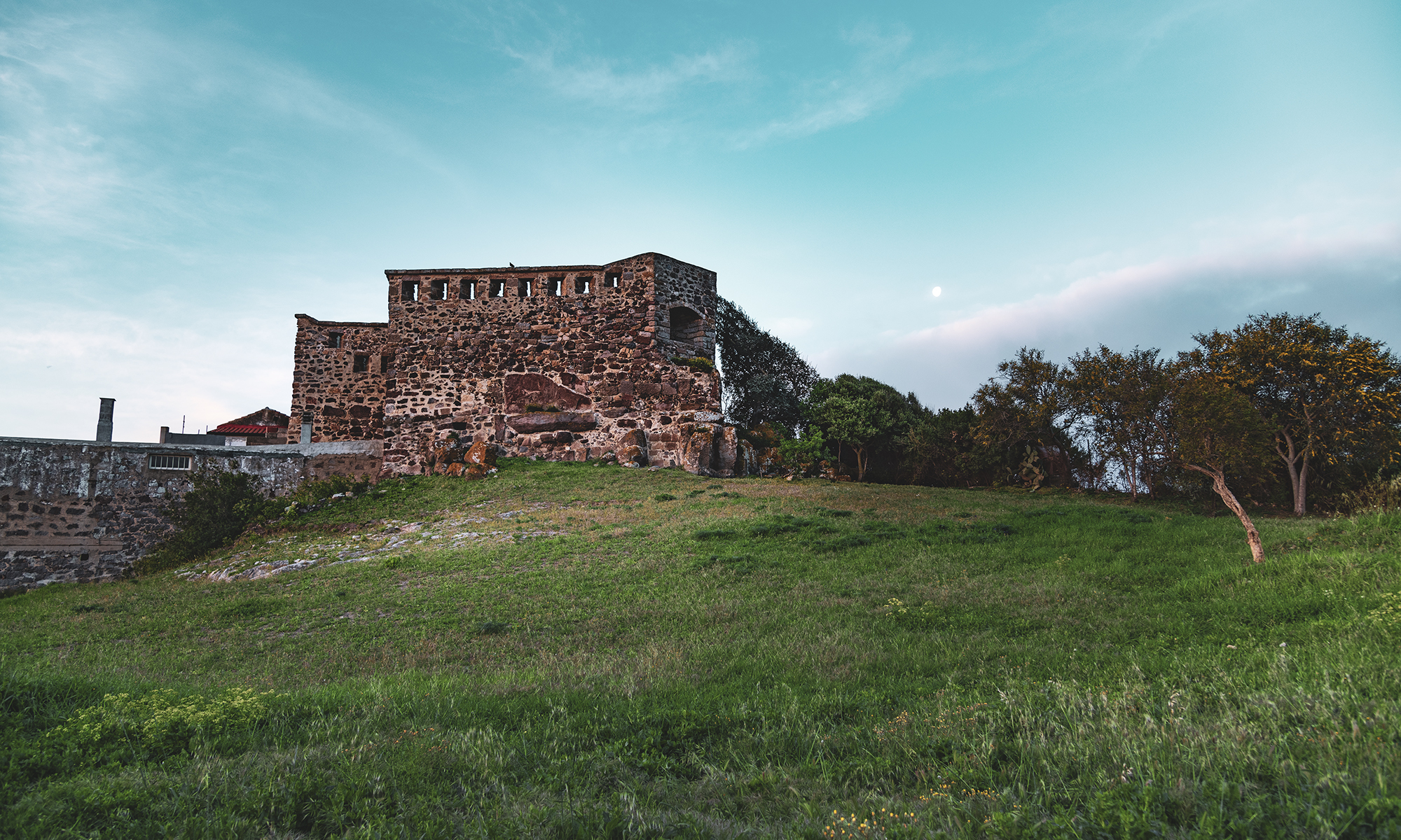
Fort Su Pisu
Forte Su Pisu is the undisputed symbol of the Antiochian resistance. It stands proudly on the hill in defence of the entire lagoon and the town of Sant'Antioco, to remind us of the enormous courage our ancestors had in facing the Barbary pirates that continuously besieged the island.
Location: Via Castello, 17
The Savoy Fort, also known by the name of 'Sa guardia de su pisu', was built between 1813 and 1815, faithfully following the design of the Officer of the Royal Artillery of Savoy Ambrose Capson. Its purpose was to give shelter to the soldiers and inhabitants of Sant'Antioco, threatened by the numerous incursions from the North African cities of Tunis, Algiers and Tripoli, former rulers of the Ottoman Empire. Beneath the fort, in the past, were the Punic walls of the ancient city of Sulky, which, in turn, had been built by partially demolishing a nuraghe.
Listen to the podcast

In October 1815, a bloody battle took place here that saw all the Antiochians on the front line defending their country. The commander of the Sardinian Artillery Efisio Melis Alagna and his team valiantly fought the Africans, commanded by Rais Siddi AbzunamaUnfortunately, they were unable to repel the attack from the blockhouse, which was stormed and taken. The commander and his brave soldiers preferred death to slavery.
Today, you can retrace the steps of our ancient past by visiting Forte Su Pisu, a bulwark of our resistance.
STAGE 2
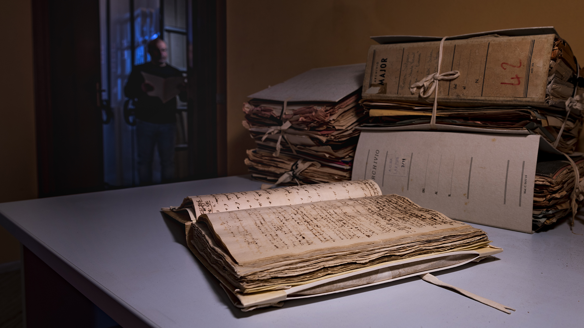
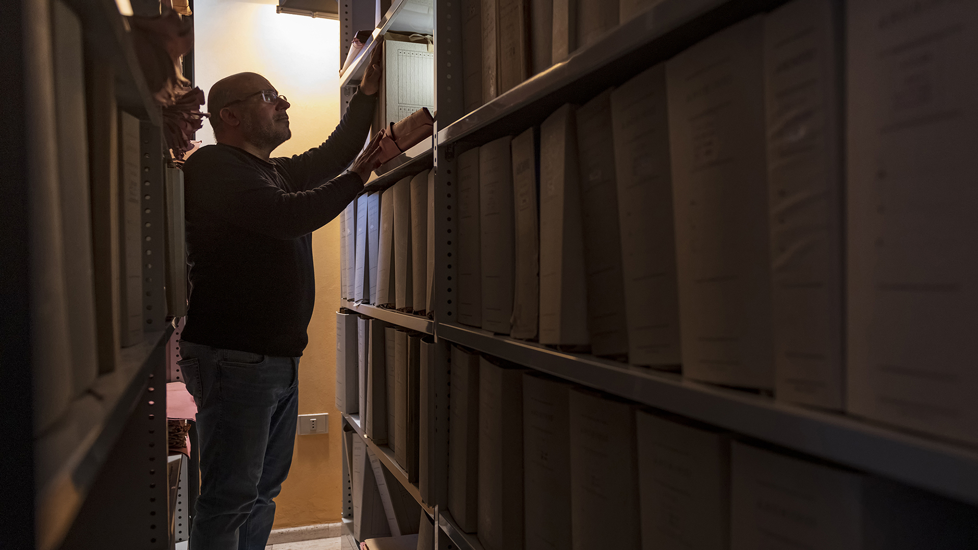
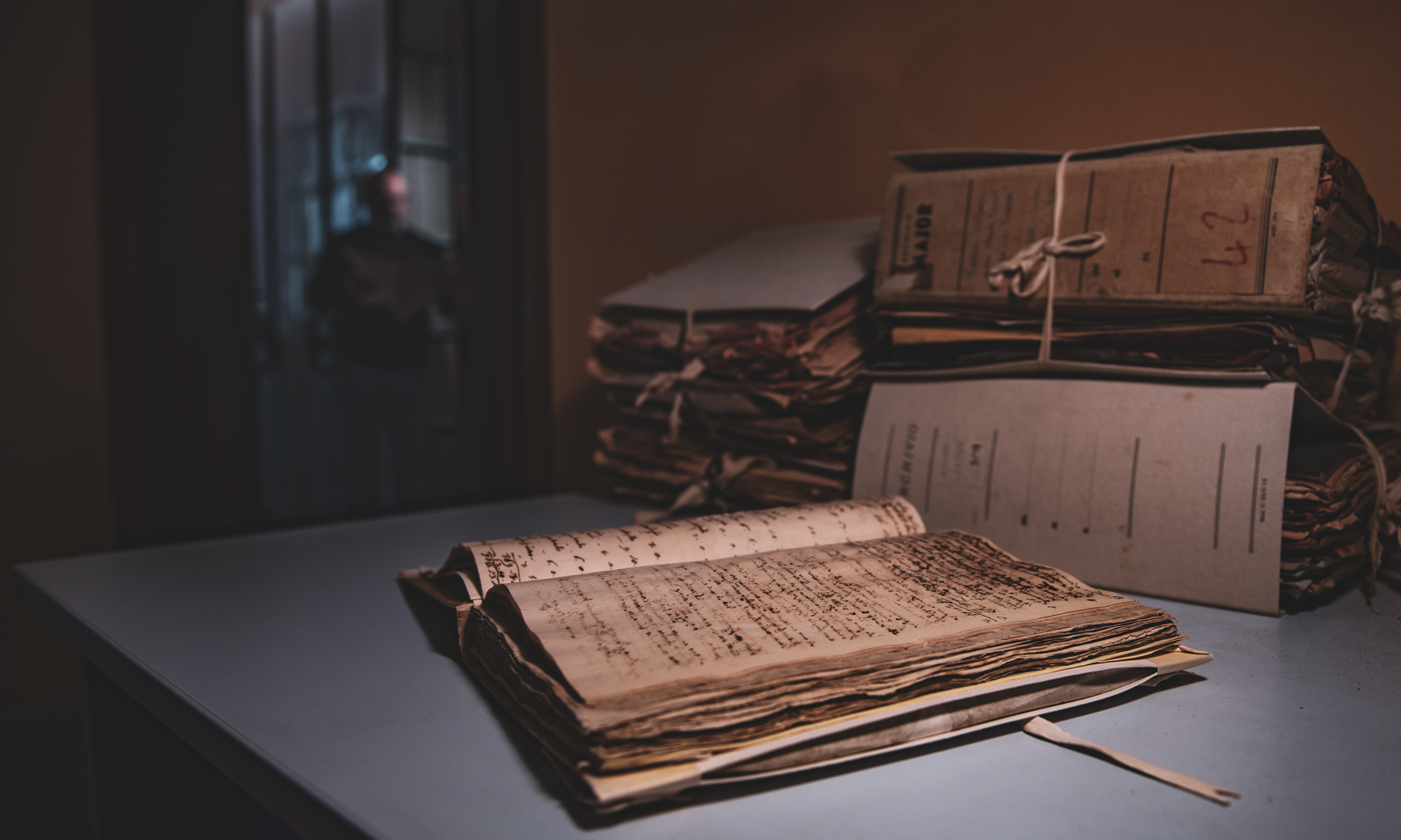
Historical Archive
Letters, words, pages that reveal priceless details and information about our history and our past over the last three hundred years. This is what the Historical Archive of Sant'Antioco is: a treasure chest that holds a multitude of treasures.
Location: Via Castello, 2
The Historical Archive is located in the former Carabinieri Barracks on Horseback, a building restored in April 2000. A didactic workshop is operated here that allows schools to study local history directly through original sources.
The archive preserves documents dating back to the 18th century, concerning practices completed over 40 years ago by the municipality of Sant'Antioco. These documents tell the political, social and economic history of the Antiochian community, illustrating the transformations of the territory and current urban development. This collection represents a valuable resource for historical research.
Listen to the podcast
Among the treasures of the archive, the volume "Registro de entrada y salida de los dineros de esta comunidad de San Antiogo ut intus".which documents the activities of the Community from 1793 to 1815. In addition to describing agro-pastoral activities, the register narrates key moments in the modern history of Sant'Antioco. The island, frequented by farmers, fishermen and numerous pilgrims during the feast of the Saint (celebrated a fortnight after Easter), was only permanently repopulated from 1750 onwards.
STAGE 3
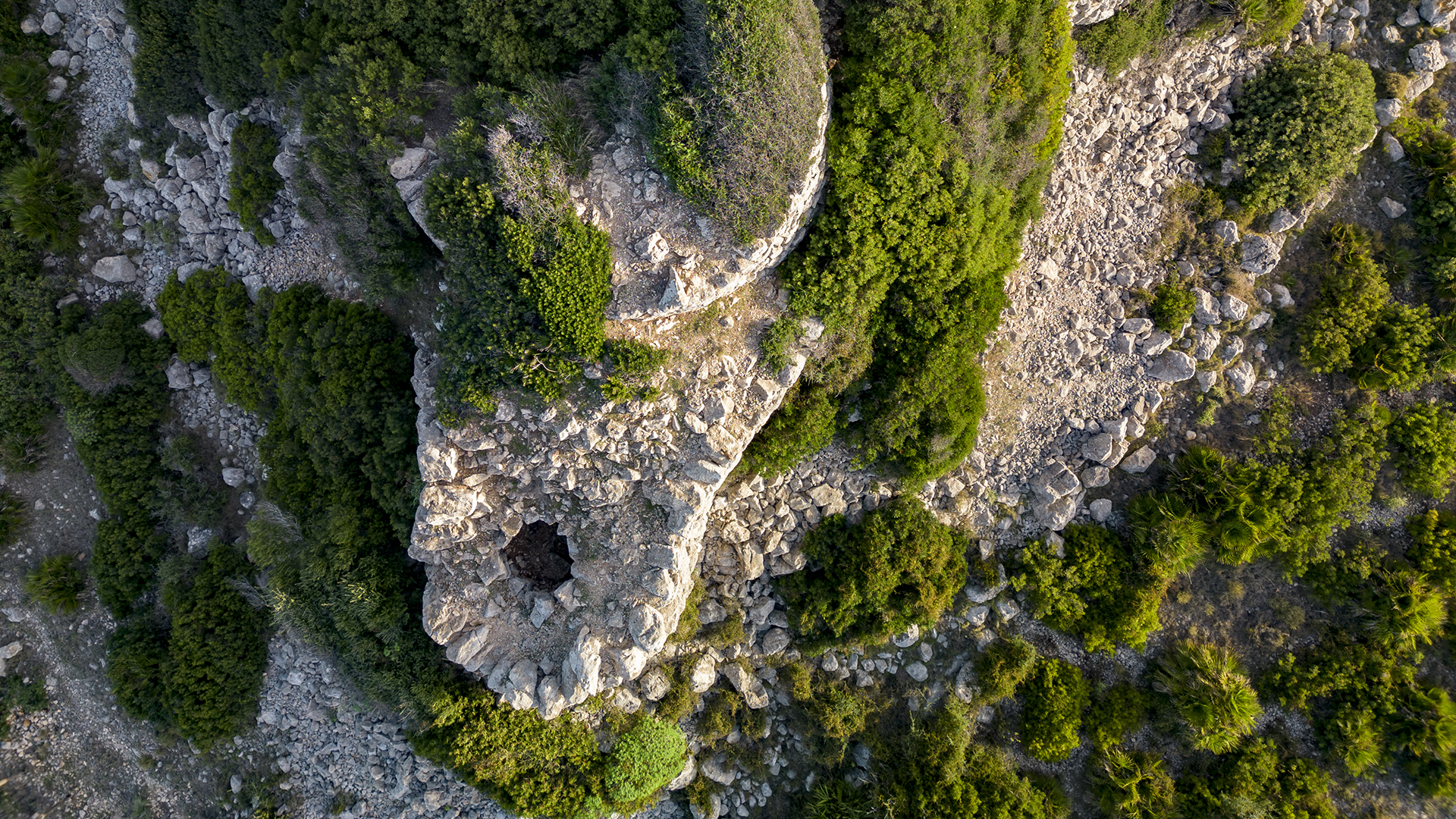
Nuraghe S'Ega de Marteddu
Sant'Antioco preserves important evidence of the Nuragic civilisation that developed here from the Middle Bronze Age onwards. On the island you will find 40 nuraghi, 14 villages, 9 tombs of the giants and a well temple. An immense archaeological heritage that will introduce you to the history of our ancestors.
Location: Nuraghe S'Ega Marteddu
One of the most important and best-preserved nuraghi on the island is certainly that of S'Ega de Marteddu. It consists of a keep and a bastion probably with three towers. The main tower, which is now almost completely intact, is covered by earth and scrub.
Listen to the podcast

From this nuraghe you can enjoy a spectacular view of the bay of Maladroxia. Its strategic position allowed it to control one of the best landing points in the Gulf of Palmas, which was also the access point to the sea of the island's main river: the Rio Triga.
But this is not the end of the story. In fact, it is assumed that this nuraghe was part of a system controlling the mouth of the Rio Triga, together with other nuraghi located to the east of the Canai plain, such as the nuraghe de is Orrùthe nuraghe Feminedda and the nuraghe S'Uttu de Su Para.
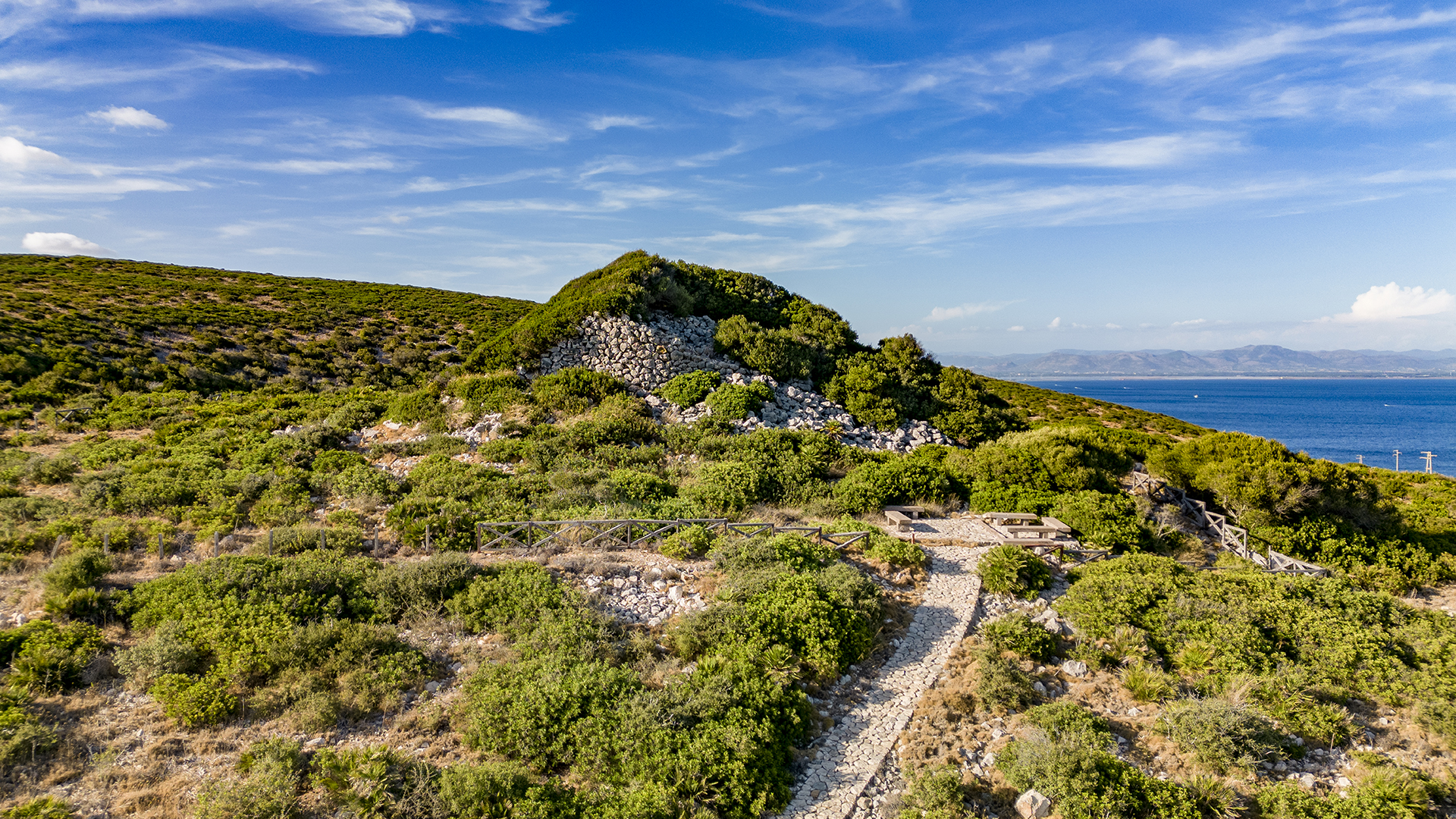
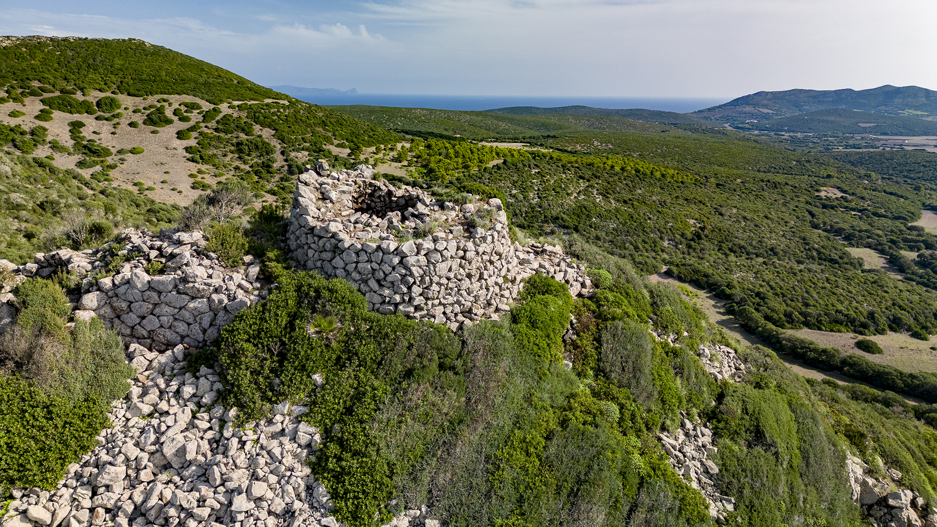
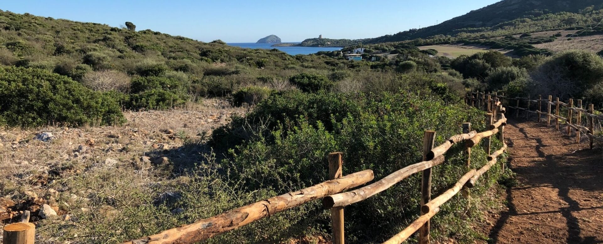
STAGE 4
Serra is Tres Portus
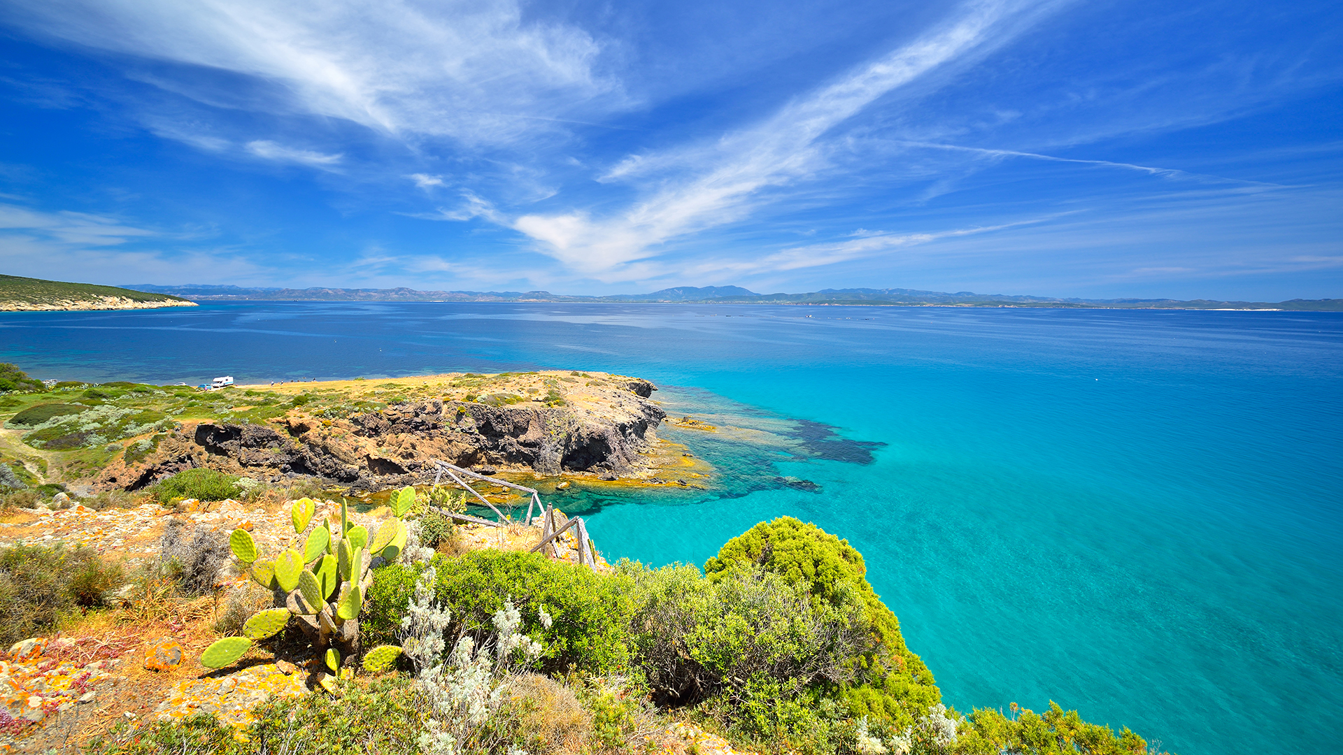
Serra Is Tres Portus is a wonderful nature trail completely immersed in nature and the Mediterranean maquis. Amidst archaeological remains and enchanting landscape views, you will discover an oasis of peace and well-being.
Location: Serra is Tres Portus (SAC)
Serra Is Tres Portus is an area recognised as a Special Area of Conservation and an Area of Community Interest for the protection and preservation of its valuable habitats. It is about 260 hectares wide and encompasses a great variety of landscapes ranging from the coastal coastline to the hilly area, which is traversed by a path through the Mediterranean maquis, about 1.5 km long. Along the way, you will see the remains of a corridor nuraghe, 20th century lime kilns and spectacular views of the surrounding landscape.
Listen to the podcast

The uniqueness of this itinerary lies in the large number of plant species present, such as wild lavender, Broom, Phoenician Juniper, Helichrysum, Dwarf Palm and the wonderful Ophrys maladroxiensis. This particular orchid is named after the locality of Maladroxia where it was discovered and where it is uniquely found. The flower has white petals with delicate shades tending towards pink and grows on a soil of calcareous rock debris, typical of this area.
STAGE 5
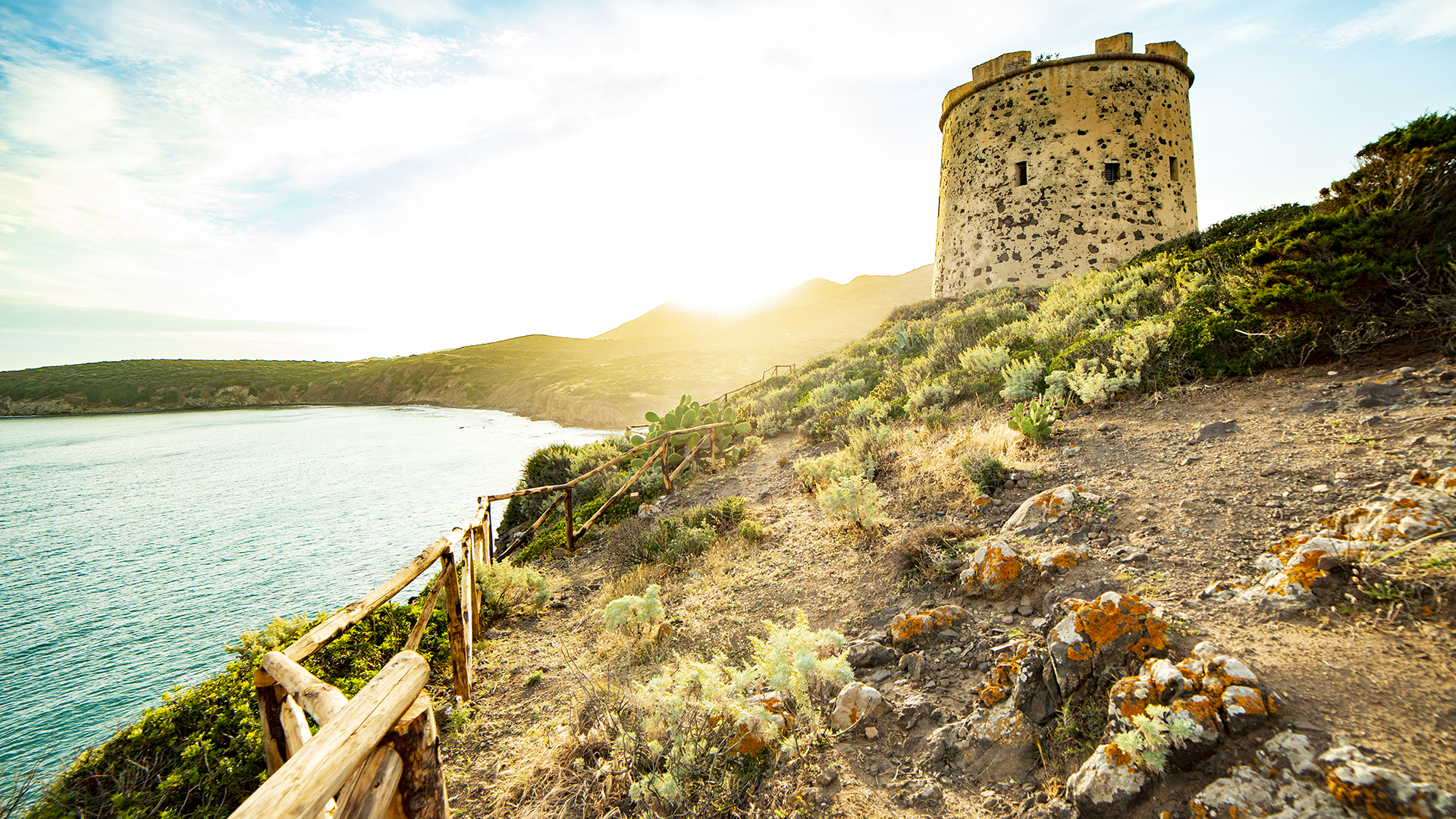
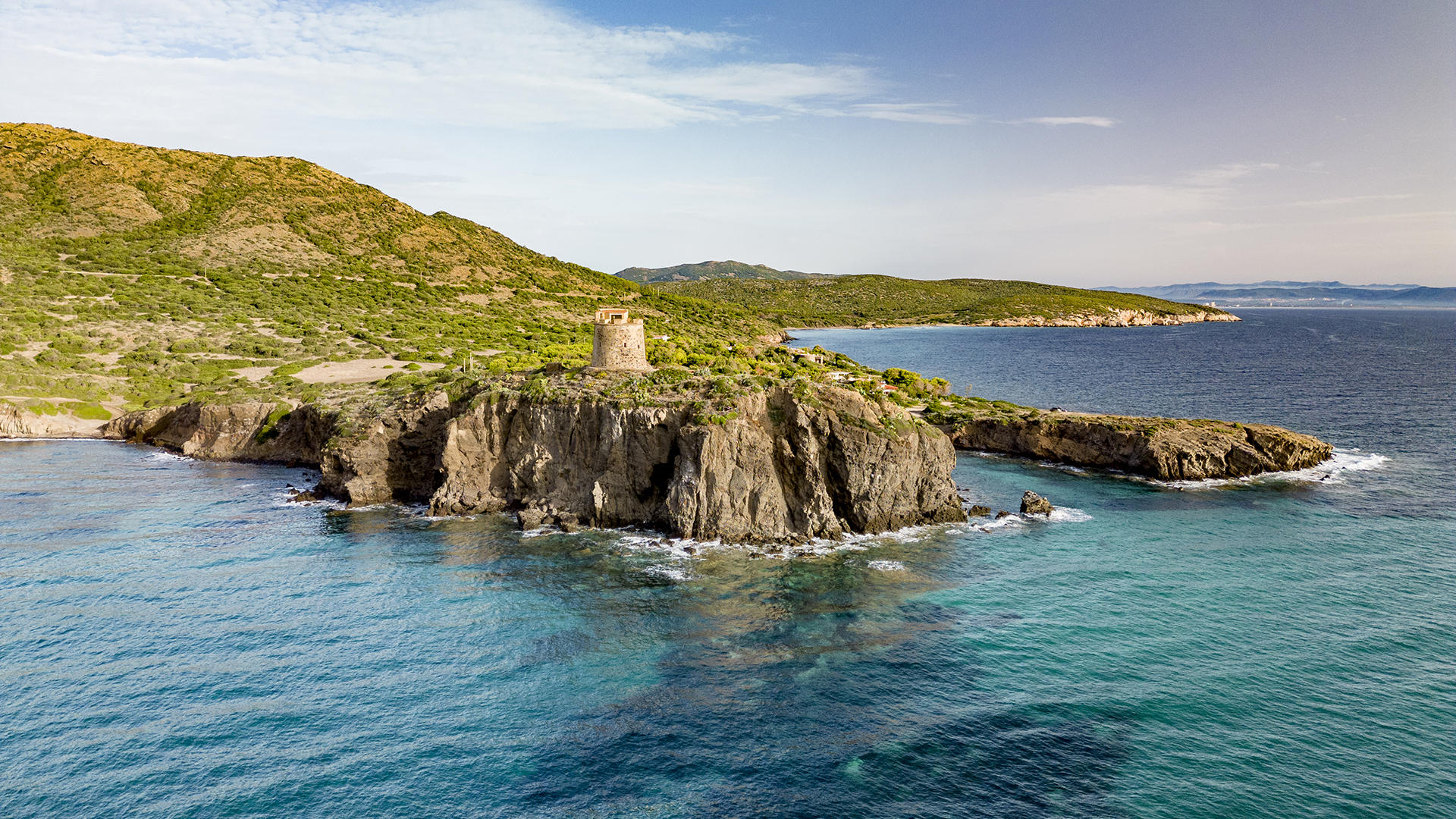
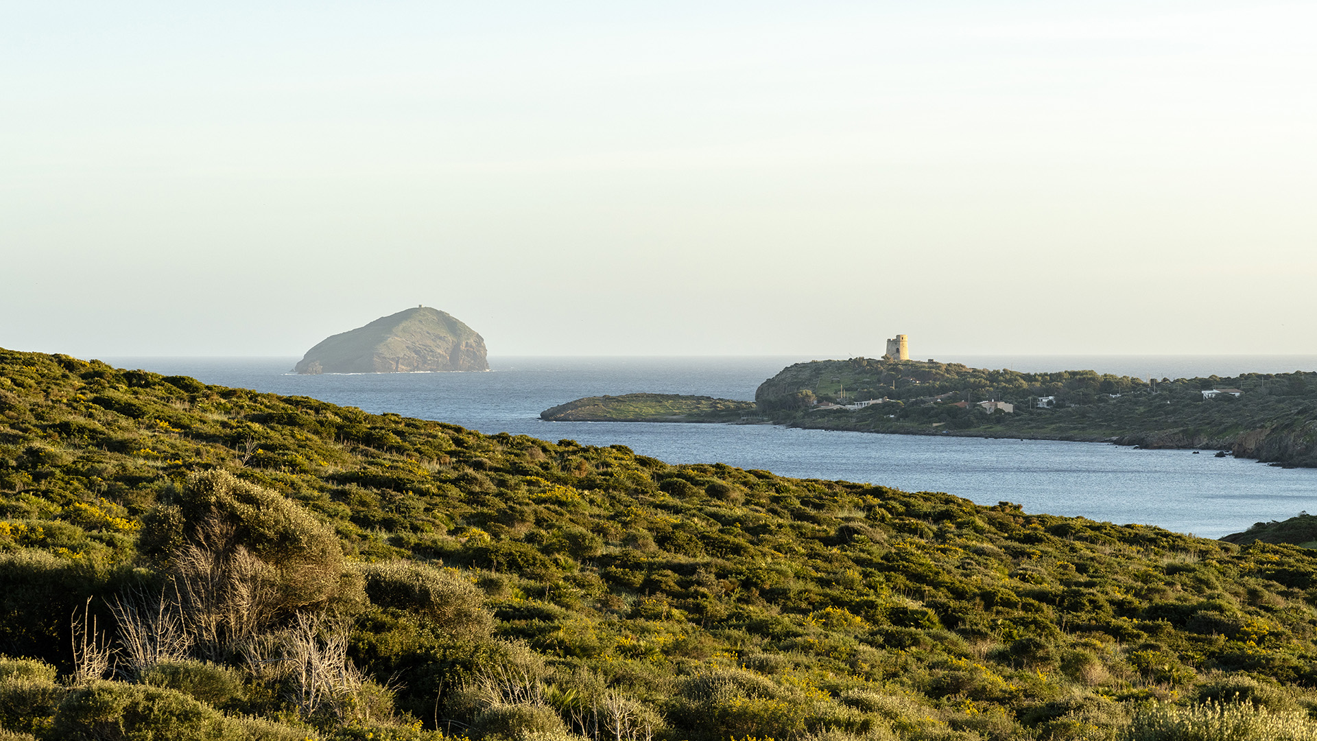
Canai Tower
Torre Canai is the first defence against the invaders that tried to attack the island in the past: it was involved in the events of the French Expedition to Sardinia in 1793, but also in the continuous raids of the Barbary corsairs that continued until the first half of the 19th century.
Location: Torre Canai
Torre Canai was built in 1757 to a design by the Piedmontese military engineer Vallin to control the entire Gulf of Palmas. The promontory on which it stands is called 'su moru' (the Moor) and stood for all the Barbary corsairs who used to make their raids in the area.
The structure of the tower is very similar to other coastal towers in Sardinia and is a truncated cone topped by a cylinder. It consists of a large circular room with four windows and an internal staircase leading to what was once the parade ground.
The Tower's main function was to sight and communicate news to the military units in charge of the island's defence both during the attempted French invasion in 1793 and during the last two Tunisian raids in 1812 and 1815.
Listen to the podcast

Today, thanks to the Italia NostraIt has been restored and opened to the public, offering an informative tour of its history, and occasional cultural events are hosted inside. The entrance to the tower is at free and conscious offeringto support the restoration and maintenance of the site.
You can explore the surroundings by taking walks along the coast, contemplate the beauty of the surrounding nature from the benches, or relax on one of the nearby beaches.